Earthquake of magnitude 4.6 - 298 km WSW of Tual, Indonesia
Earthquake of magnitude 4.8 - Banda Sea
Earthquake of magnitude 5.3 - 277 km SSE of Amahai, Indonesia
 1 år sedan
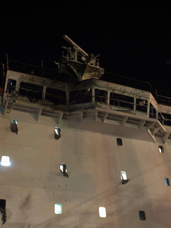
Rysk Kh-31P missil träffade civilt fartyg under Liberias flagg nära Odesa, 3 besättningsmedlemmar, medborgare i Filippinerna, skadade
Earthquake of magnitude 4.6 - Banda Sea
Earthquake of magnitude 4.6 - Banda Sea
Earthquake of magnitude 5.0 - Banda Sea
Earthquake of magnitude 4.8 - 285 km W of Tual, Indonesia
Earthquake of magnitude 4.6 - Banda Sea
Earthquake of magnitude 4.6 - Mariana Islands region
Earthquake of magnitude 6.7 - Banda Sea
Earthquake of magnitude 4.9 - near the north coast of Papua, Indonesia
Earthquake of magnitude 4.7 - Banda Sea
Earthquake of magnitude 4.6 - Banda Sea
Fire detected from Sentinel2 Place: Shire of East Pilbara, Western Australia, Australia
Earthquake of magnitude 4.7 - 84 km ESE of Masohi, Indonesia
Earthquake of magnitude 4.6 - Banda Sea
Earthquake of magnitude 5.1 - Banda Sea
Earthquake of magnitude 5.1 - Banda Sea
 1 år sedan
USGS reports second earthquake, measuring 7.0, in the Banda Sea in Indonesia
Earthquake of magnitude 7.0 - Banda Sea
Earthquake of magnitude 6.9 - Banda Sea
Earthquake of magnitude 6.9 - Banda Sea
Earthquake of magnitude 5.6 - Pagan region, Northern Mariana Islands
Earthquake of magnitude 4.6 - Kepulauan Babar, Indonesia
Earthquake of magnitude 4.7 - Solomon Islands
Earthquake of magnitude 5.3 - 47 km NNE of Auki, Solomon Islands
Earthquake of magnitude 5.4 - 52 km NNE of Auki, Solomon Islands
Earthquake of magnitude 4.9 - 58 km N of Auki, Solomon Islands
Earthquake of magnitude 4.8 - 145 km SW of Tambolaka, Indonesia
Earthquake of magnitude 5.2 - 82 km E of Kokopo, Papua New Guinea