 6 mes atrás
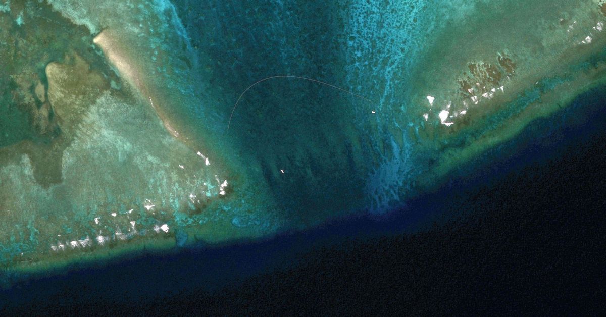
Satellite photos capture China's floating barrier, which restricts indigenous Philippines fishermen's access to Scarborough Shoal & threatens their food security-all while China's industrial & illegal clam harvesters systematically destroy the shoal's fragile ecosystem. Satellite images reveal floating barrier at mouth of disputed atoll in South China Sea
 6 mes atrás
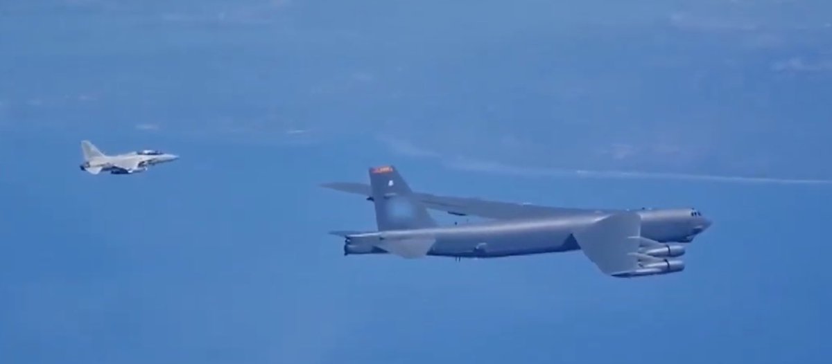
Nuclear-capable B-52 bomber flies with Philippine fighters over the South China Sea in signal to China
The bodies of three people have been discovered in two separate locations - a child among the deceased.
Earthquake of magnitude 5.1 - 114 km ENE of Barcelona, Philippines
Earthquake of magnitude 5.0 - 68 km NW of Finschhafen, Papua New Guinea
Earthquake of magnitude 4.8 - 69 km W of Ambunti, Papua New Guinea
Earthquake of magnitude 4.9 - 234 km ESE of Tadine, New Caledonia
Iran's IRGC on Sunday seized a foreign oil tanker carrying around two million liters of "smuggled fuel" near the country's southern coast, local media reported."A foreign vessel with the flag of a country from Oceania was seized with two million liters of smuggled diesel.”
Earthquake of magnitude 4.6 - Maug Islands region, Northern Mariana Islands
Earthquake of magnitude 4.9 - 71 km E of Tobelo, Indonesia
Earthquake of magnitude 5.0 - 105 km SSE of Sarangani, Philippines
Earthquake of magnitude 4.9 - 17 km NNE of Sape, Indonesia
Earthquake of magnitude 5.1 - 11 km S of Wewak, Papua New Guinea
Earthquake of magnitude 4.6 - 29 km ENE of Port-Olry, Vanuatu
Earthquake of magnitude 5.4 - south of Java, Indonesia
Soldiers kill 2 suspects in Marawi bombing, 6 others in Lanao del Sur
Earthquake of magnitude 5.5 - 135 km E of Madang, Papua New Guinea
Earthquake of magnitude 5.1 - 290 km NE of Fais, Micronesia
Earthquake of magnitude 4.7 - 9 km ENE of Solsona, Philippines
Earthquake of magnitude 5.1 - 95 km N of Lae, Papua New Guinea
Earthquake of magnitude 5.1 - 94 km ESE of Kimbe, Papua New Guinea
Earthquake of magnitude 5.7 - 80 km ENE of Ruteng, Indonesia
Earthquake of magnitude 5.0 - 155 km S of Vanimo, Papua New Guinea
Earthquake of magnitude 5.1 - 26 km ESE of Dannevirke, New Zealand
Earthquake of magnitude 4.9 - 206 km S of Banjar, Indonesia
Earthquake of magnitude 4.8 - 47 km NNW of Dededo Village, Guam
Earthquake of magnitude 5.3 - 299 km W of Tual, Indonesia
Earthquake of magnitude 5.0 - Volcano Islands, Japan region
Earthquake of magnitude 6.5 - 57 km WSW of Port-Vila, Vanuatu
Earthquake of magnitude 6.3 - 43 km SW of Port-Vila, Vanuatu