 1 rok Před
Reportér: Budete diskutovat o AUKUSu Trump: Co to znamená Reportér: Australská americká obranná aliance
Earthquake of magnitude 5.1 - 41 km ENE of Ruteng, Indonesia
Earthquake of magnitude 4.7 - 217 km N of Tobelo, Indonesia
 1 rok Před
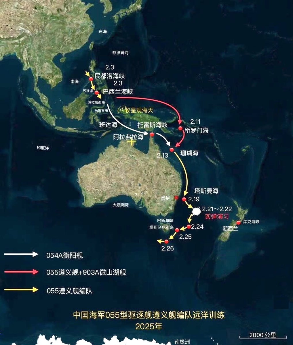
Map from Chinese media showing the route followed by the PLA Navy task force operating off the coast of Australia
Earthquake of magnitude 4.7 - 60 km E of Modisi, Indonesia
Earthquake of magnitude 5.0 - 132 km WNW of Ternate, Indonesia
Earthquake of magnitude 4.7 - 65 km E of Modisi, Indonesia
Earthquake of magnitude 5.1 - 55 km ESE of Modisi, Indonesia
Earthquake of magnitude 4.9 - 58 km E of Modisi, Indonesia
Earthquake of magnitude 4.8 - 58 km ESE of Modisi, Indonesia
Earthquake of magnitude 4.9 - 61 km E of Modisi, Indonesia
Earthquake of magnitude 5.0 - 59 km E of Modisi, Indonesia
Earthquake of magnitude 4.9 - 54 km E of Modisi, Indonesia
Earthquake of magnitude 4.6 - 45 km ESE of Modisi, Indonesia
Earthquake of magnitude 4.9 - 42 km ESE of Modisi, Indonesia
Earthquake of magnitude 6.1 - 44 km E of Modisi, Indonesia
Earthquake of magnitude 5.1 - 209 km NW of Tobelo, Indonesia
Earthquake of magnitude 4.9 - 158 km NNE of Bitung, Indonesia
 1 rok Před
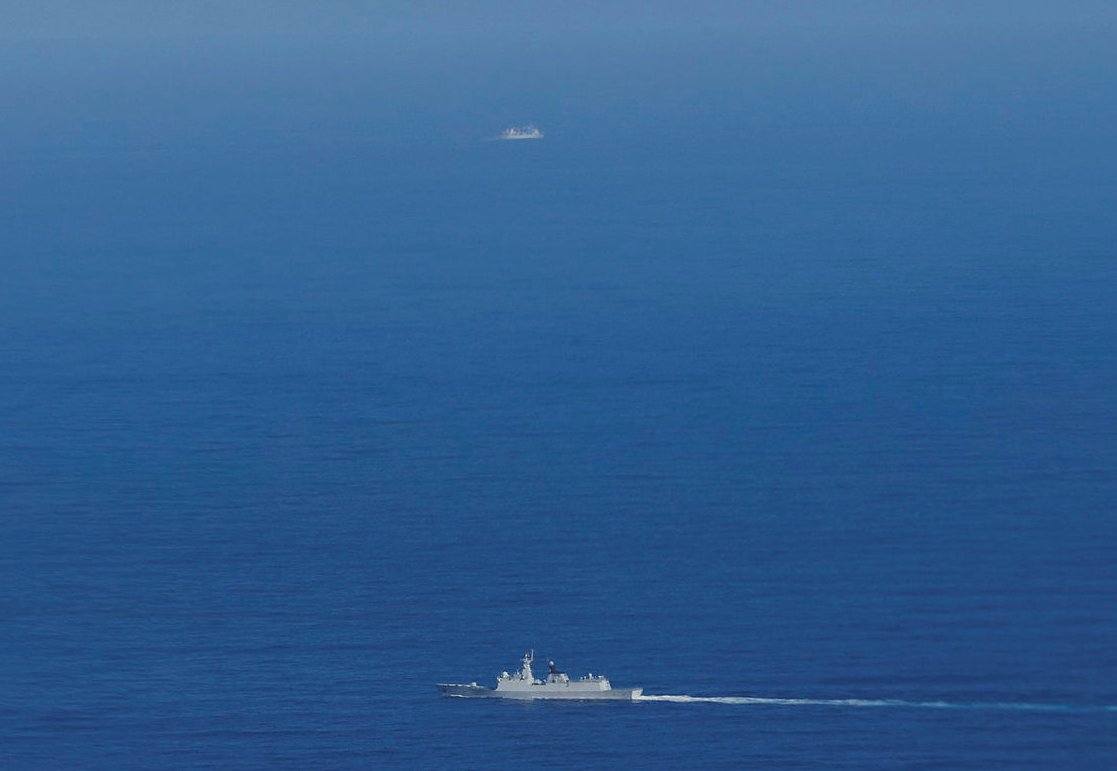
The Defence Department has released more pictures of the Chinese warships in the Tasman Sea, which have now moved back into Australia's EEZ and are roughly 300 kilometres east of Hobart
Reuters quoting an Australian official: Chinese naval exercise in the Tasman Sea forced 49 flights to change their routes
Earthquake of magnitude 4.7 - 43 km NE of Ambunti, Papua New Guinea
Earthquake of magnitude 4.8 - 283 km SSW of Pagar Alam, Indonesia
Earthquake of magnitude 5.2 - 122 km W of Panguna, Papua New Guinea
Earthquake of magnitude 4.9 - 26 km N of Waingapu, Indonesia
Earthquake of magnitude 6.0 - 84 km SSE of Lata, Solomon Islands
Earthquake of magnitude 4.9 - 56 km SW of Wewak, Papua New Guinea
Earthquake of magnitude 5.0 - 292 km S of Bengkulu, Indonesia
Earthquake of magnitude 5.1 - 296 km SSW of Pagar Alam, Indonesia
Earthquake of magnitude 5.4 - 125 km SSE of Panguna, Papua New Guinea
Earthquake of magnitude 4.9 - 127 km S of Panguna, Papua New Guinea